Geography-Based (Atlas) Maps

Geography-Based (Atlas) Maps

Geography-Based (Atlas) Maps

Geographic ‘space’ is one of the fundamental concepts that we humans have invented for making sense of, and mentally & physically structuring, our world and everything in it. Indeed for over 2,000 years we have been perfecting the art & science of cartography to record what things of particular types exist where within a defined space, both for ourselves and so we can easily communicate it to others.

Our atlas knowledge maps provide an alternative visual framework to ‘traditional’ geographic maps for visually recording & communicating what ‘geographically defined things’ of a particular type exist in the real world, and the relationships between them – be they at global, international, national or local level.  However they also serve as both an index of, and a virtual portal to, all the definitive / official / plain old useful knowledge resources that currently exist about these ‘things’ in the public domain, and so can be freely accessed with a couple of mouse clicks.

With potentially 1000’s of branches – each of which can have multiple attached hypelinks & tags, or embedded images and data elements – they are information rich, visually engaging, intuitive to navigate, and retain the ‘big picture’ context. They are also more versatile and much easier to adapt & share ‘on the hoof’.

Show more...

NOTE: We’re currently rebuilding our knowledge map store and upgrading the contents to take advantage of advances in MindManager capabilities. Knowledge maps in each category / sub-category will appear in due course.

Play Video

Are you all sitting comfortably? Then we’ll begin…

Explore our Atlas Map Categories and Featured Map below. New to our knowledge maps? Explore our Map Guide to find out about the anatomy of the different map elements and how once they are combined they are more than the sum of the parts, the 2 different file formats, using HTML maps for beginners, the user benefits of our maps and the background of how we came to create them and offer them to the world in this Map Store 🙂

Profile_Angus_McDonald_400x400
As well as being the definitive list of the different 'building blocks' of our world, our knowledge maps are a visually structured, curated by a human, comprehensive index of – and ‘discover within the big picture context, minimal click’ portal to – all the official / definitive / plain old useful knowledge resources to be found about them that are freely available in the public domain. All in a single shareable, archivable file. THe HTML version is viewable on any any modern browser, on any device, without the need for any plugins, or indeed an internet connection to view it once it has been downloaded (so it can be viewed offline, in remote locations with no signal).
Angus McDonald
Scotland The Map Project Director and Knowledge Mappers Founder & CEO
Profile_Angus_McDonald_400x400
And as every MindMaanger user knows, as well as the map being your single source of truth at any time, it is just the starting point, which will grow with you as your knowledge grows, through every step of whatever process you are applying it to.
Angus McDonald
Scotland The Map Project Director and Knowledge Mappers Founder & CEO
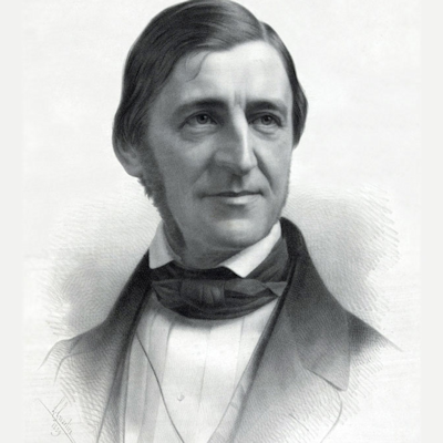
Image_Ralph-Waldo-Emerson_400x400
Do not only go where the path may lead, go instead where there is no path and leave a trail.
Ralph Waldo Emerson
Philosopher and Transcendentalist
Image_Gilbert-Hovey-Grosvenor_250x250
A map is the greatest of all epic poems. It's lines and colours show the realisation of great dreams.
Gilbert Hovey Grosvenor
'Father of Photo-Journalism' & 1st Full-Time Editor Of National Geographic Magazine

Featured Resource

Countries of the World - General & Geographic Atlas

MAP CURRENTLY IN BETA – COMING SOON

Map_Meta_Countries-General_Description_Dev06

Our Countries of the World – General & Geographic Knowledge Atlas is a visually structured, curated by a human, comprehensive index of – and ‘discover within the big picture context, minimal click’ portal to – over 20,000 official / definitive / ‘plain old useful’, public domain, general and geographic knowledge resources about each of the 249 ISO3166-1 defined ‘Countries & Territories of the World’, and the UN Geoscheme (M49 standard) defined Macro Geographic Regions and Sub / Intermediary Regions within which they sit.

It builds on the knowledge framework provided by our ISO3166-1 Countries Of The World – Base Atlas through the addition of collections of knowledge resource links sub-branches ‘built out off of’ the country seed branch, each with a single hyperlink to official / definitive / plain old useful General or Geographic knowledge resources about it found in the public domian….

General Knowledge Resource Links Collection

There are ~24 resources in this collection for each ISO3166-1 Country of the World, including…. 

 United Nations System Bodies resources such as member state mission, data profile on UNdata as well as the World Bank Open Data portals, Sustainable Development Goal (SDG) status, the UN Global Disaster Alert and Coordination System (GDACS) Portal, and environmental challenge-related resources like the Nationally Determined Contributions (NDC) Registry under the United Nations Framework Convention on Climate Change (UNFCCC) and the World Bank Climate Change Knowledge Portal.

 Wikimedia Projects resources such as the Wikipedia Category & Main Article, Portal, Outline & Index of Country-related articles and other Wiki Foundation projects like the Wikimedia Commons Index of Country-related images & media files and the Wikivoyage crowd-sourced Travel Guide.

As well as BBC News, the CIA World Fact Book , Factsheets & Foreign Governments (‘World Leaders’) Directory, ISO 3166 Online Portal and the main National Government & official Tourist Information websites.

Geographic Knowledge Resource Links Collection

There are ~20 resources in this collection for each ISO3166-1 Country of the World, including…. 

 United Nations System Bodies resources such as static map libraries from the United Nations Geospatial Division & agencies (eg. UNITAR).

 Wikimedia Projects resources such as the Wikipedia Geography Sub-Category & Main Article (& the Geography-related Lists), and the WikiMedia Commons Atlas of the World static map library.

As well as online mapping services like Google Maps (& it’s 3D cousin Google Earth Web), Open Street Map & what3words (with a summary of all available services on GeoHack),  the World Atlas static map library, and the Geonames opensource of Administrative Divisions and other basic spatial data.

It’s All About That Base

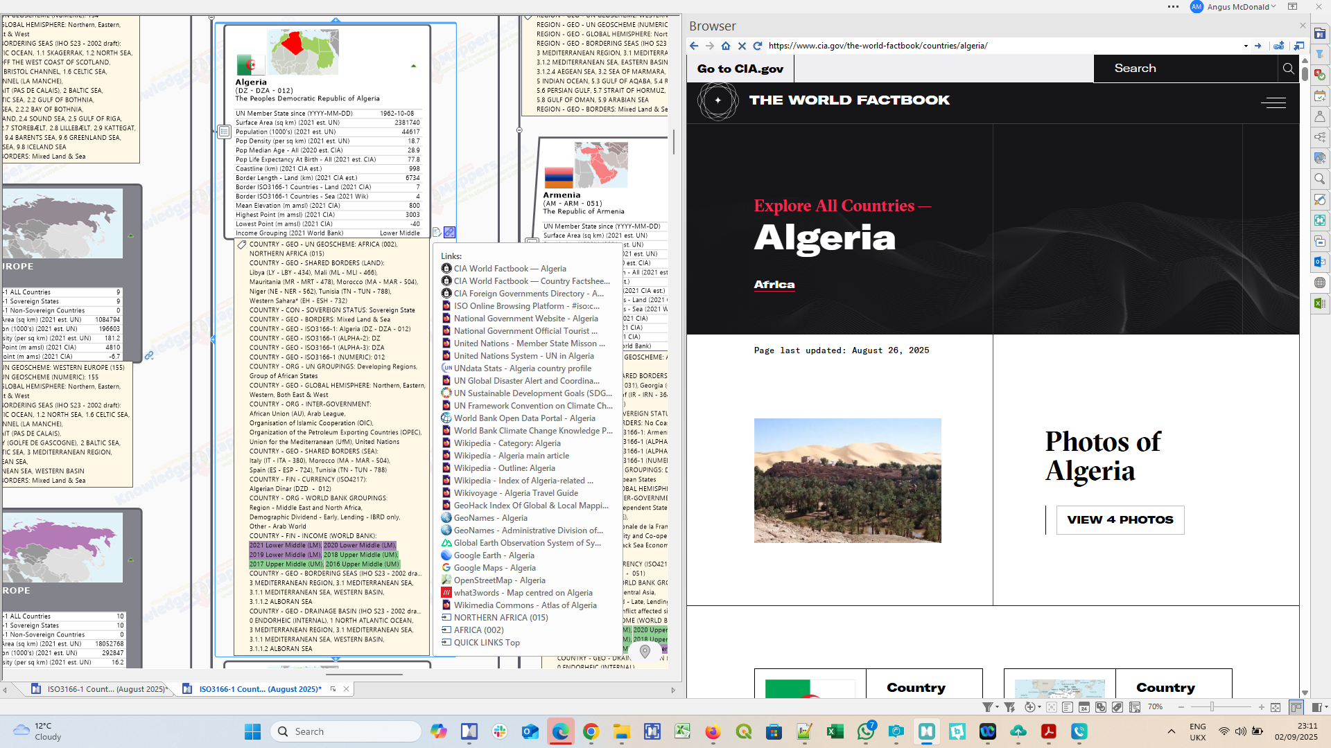
As in all our ‘atlas’ knowledge maps about the countries of the world, the country seed branches that these sub-branch collections of knowledge links are ‘built out on top of’ (ie. are sub-branches off of) are part of the base visual knowledge framework provided by our Countries of the World – Base Knowledge Atlas, which is comprised of knowledge seed branches for each country – as officially defined by ISO-3166-1: Codes For The Representation Of Names Of Countries – arranged as sub-branches within in an ‘org-tree’ base framework of seed branches for every UN defined Macro Geographical (Continental) Region And Sub-Region that form the ‘bigger picture’ visual & logical framework within which they sit.

Both ‘Region’ and ‘Country’ seed branches have a rich range of contextual knowledge elements visibly embedded within them or attached to them (most of which are unique to MindManager)…

Outline shape shows the nature of the country’s borders with it’s equivalent neighbours (‘island’, ‘land-locked’ etc.).

Images of thumbnail location maps & country flags.

Title text is the country’s official ‘Short’ and ‘Full’ names and 2 and 3 letter and numeric codes (as listed on the country’s entry of the official ISO3166-1 Online Browsing Platform) in variably formatted (‘rich’) text.

Single data fields of contextual geostatistical data such as geographic area & population (taken from official United Nations Data and CIA World Factbook sources).

Index marker tags add contextual knowledge, enable ‘geo intelligent’ map filtering as well as the invokation of ‘smart rules’ to conditionally format some elements (eg. the outline shape of the branch).

Internal hyperlinks enable quick navigation ‘jumps’ between related map branches, such as between the country seed sub-branches and their parent region as well as with the ‘Quick Links’ branch.

External hyperlinks to almost 30 of the most important official / definitive / plain old useful public domain general and geographic knowledge resources about the countries and macro-geographic regions of the world – such as the UNdata, CIA World Fact Book, Factsheets & Foreign Governments (‘World Leaders’) Directory and many Wikipedia Categories, Main Articles, Portals, Outlines & Lists.

See the MAP LEGEND branch in the map for a full description of all the different types of branches, and all the knowledge elements embedded within them or attached to them.

This Countries of the World – General & Geographic Knowledge Atlas map then is an invaluable ‘thumb & brain friendly’ desktop (or even ‘in the field’) research tool that will enable you to spend less of your valuable time getting lost down internet search rabbit holes so you can spend more of it actually assimilating & applying the world’s best knowledgebases about the countries and regions of this big old beautiful world of ours for the benefit of your own personal projects and / or those of the teams, organisations & communities of which you are part.

Explore the other product tabs for…


Don’t forget that you can also View  / Download a sample map in MindManager (.mmap) or HTML5 (.html) format.

HTML Map User Tips

Alhough the HTML5 (.html) map is read only, it still has all the content – and most of the interactivity – of the original MindManager map (from which it has been exported), and it can be viewed by anybody, in any modern web browser software, on any digital device, without the need for any software plugins, as stand-alone files or embedded in web pages, on(or off)-line (once downloaded).
Thus use the HTML map for it’s primary purpose – as an intuitive to use, discover within the big picture context, minimal click portal to core, public domain official / definitive / ‘plain old useful’ general & geographic knowledge resources – as well as to those in the specialized sub-branch collections – about any and all of the countries and territories that make up this big old beautiful world of ours 🙂

MindManager Map User Tips

As well as ‘full featured viewing and interactive querying & filtering, you are free to edit, add to, adapt and/or re-purpose this map in whole or in part, and/or use it as a source of content that can be added to your own existing maps. For example…

  • Create a living research document – Record the important information from the listed resources in the map – as a note or sub-branches – ‘in-situ’ as you discover it to create a ‘single source of truth’ for your research project that’s always up to date.
  • Use the content in other maps – Copy and paste a ‘GEO’ tag group to an existing map, assign to branches as appropriate, and interactively filter using your new found ‘geo-intelligence’ 😉
  • Create your own Territory Maps – Tag individual team members to specific Region / Country branches to create a virtual sales / operational territory map with built-in links to the world’s best public domain general and geographic knowledge resources (or physically re-arrange the region / county branches to form the territories).

Price: £999.99

 MAP CURRENTLY IN BETA – COMING SOON

See the full range of Buying Options (this map may also be available as part of one or more product bundles).

The map will display in a new tab in your browser on any device, however it is probably best appreciated on a larger screen like a computer or tablet. It will take 30 seconds to a minute to load.

New to our knowledge maps? Watch the brief explainer videos of what’s what below before viewing / downloading a sample of this map to play with….

Play Video
Play Video

Share

Please share this page with your networks and others you think will benefit from our visual working.

Digg
Facebook
LinkedIn
OK
Pocket
Pinterest
Reddit
Skype
StumbleUpon
Telegram
Twitter
Tumblr
VK
WhatsApp
XING
Email