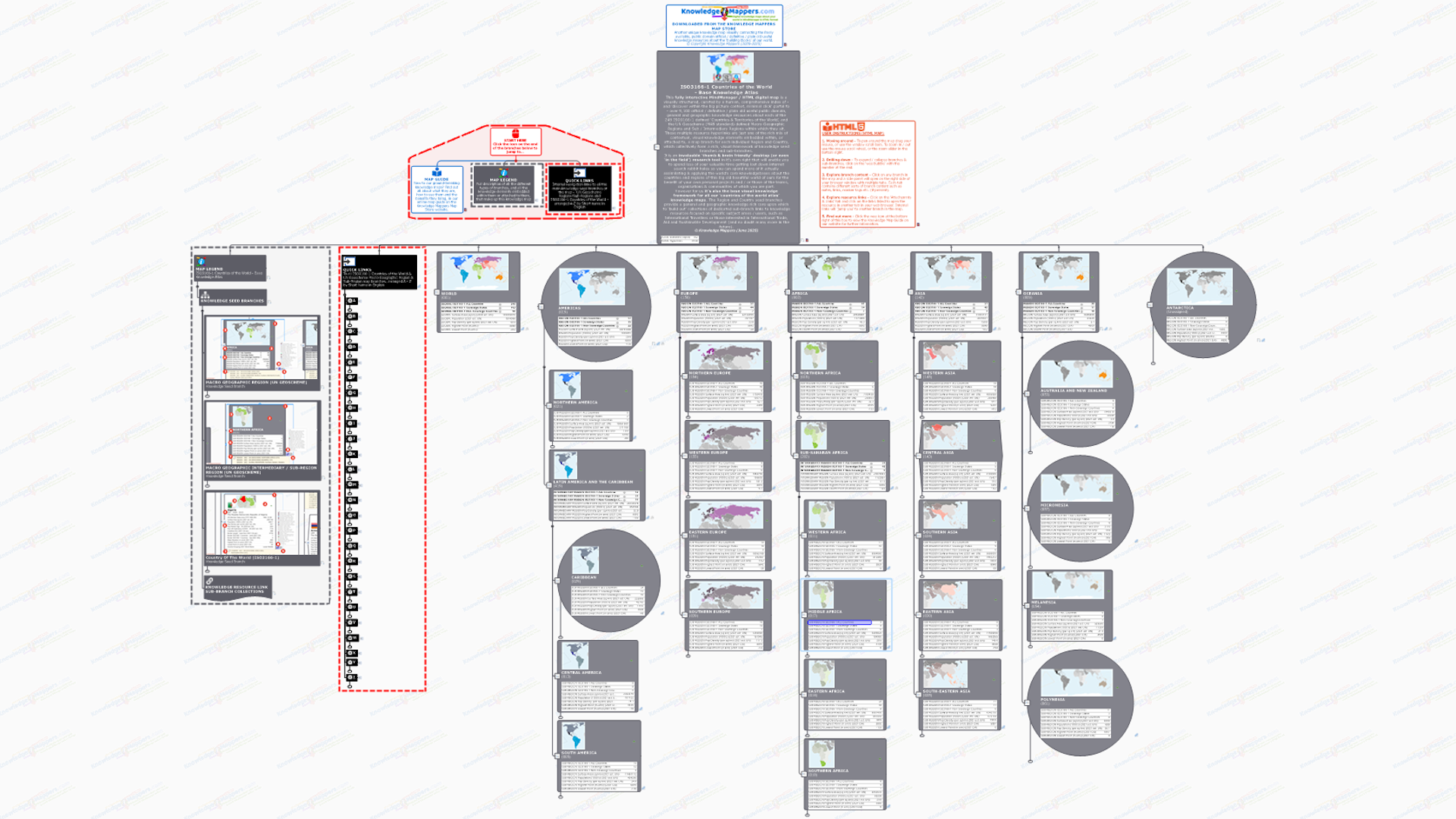
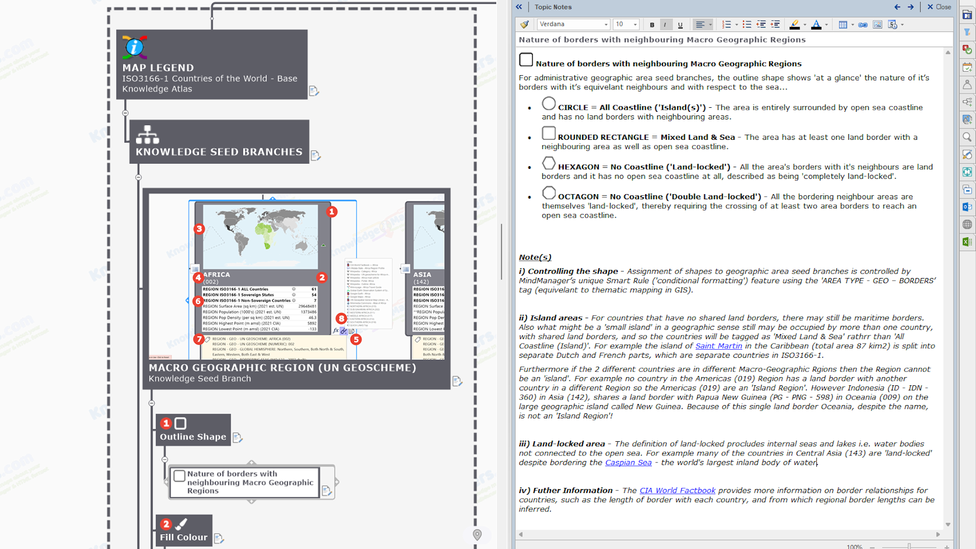
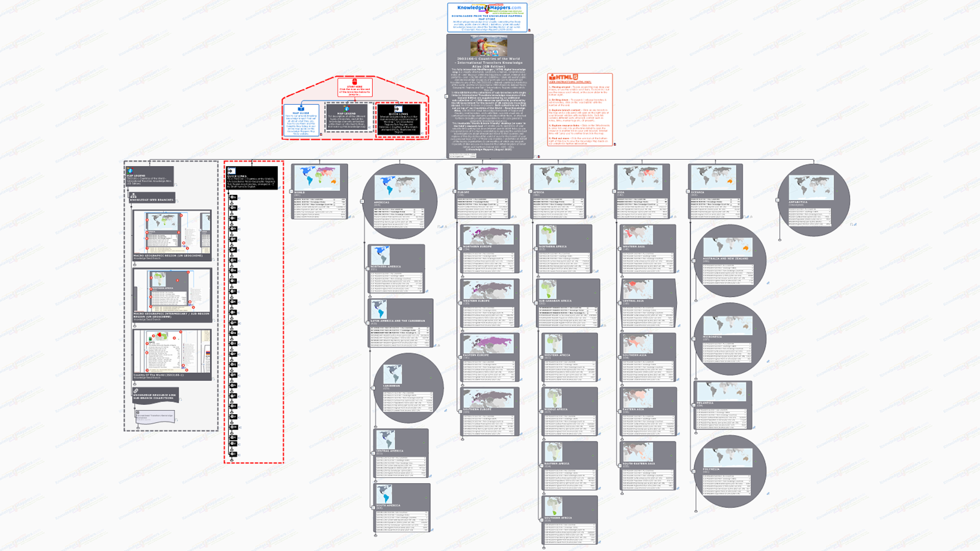
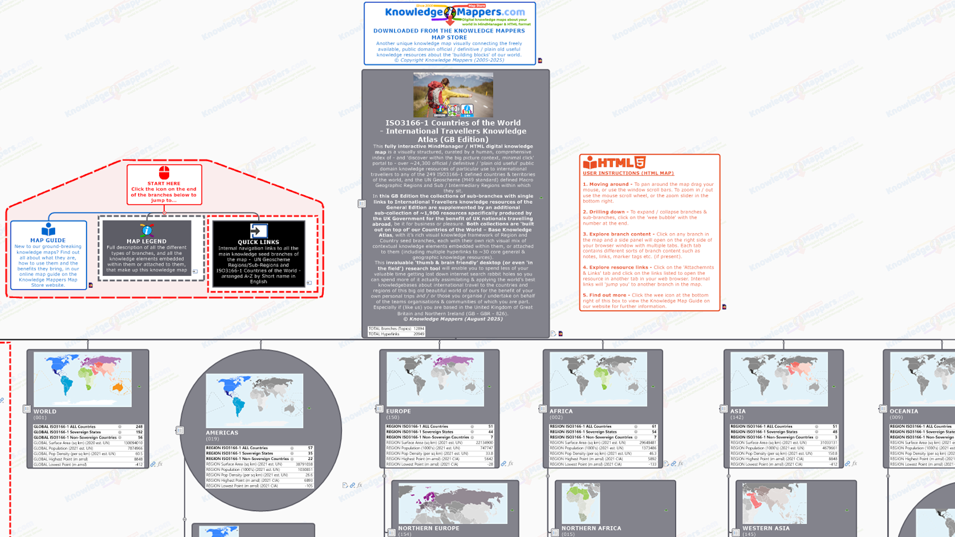
ISO3166-1 Country Of The World Seed Branch

 Introduction
  External Knowledge Resource Links
  Internal Navigation Links
.
Introduction
Uniquely to MindManger, a single map branch can have multiple hyperlinks attached to it, which can be a mixture of any of the following 4 ‘types’….
- External Link – These are Universal Resource Links (URLs) to pages on the world wide web (or an internal intranet). External links are indicated by a favicon, the ‘wee picture’ that is usually unique to the ‘linked to’ website and that it automatically supplies to MindManager (and browser software) as part of the linking process. e.g. the famous Wikipedia favicon is
 .
. - Internal Link – These links are to another branch in the same map, and they provide a quick means of internal navigation to users as clicking on it will ‘re-focus’ the map on the ‘destination’ branch. Internal links are indicated by the icon.
- File Link – The path to files stored on computer hard-drives (though it can also be embedded within the map file too). Clicking on it will open the file in the application required (which must be installed on your computer). File links are indicated by the file application icon e.g. the famous Adobe Acrobat file icon
 .
. - E-mail Link – Clicking on this will open up your default e-mail application with an e-mail to that address. E-mail links are indicated by the
 icon.
icon.
.
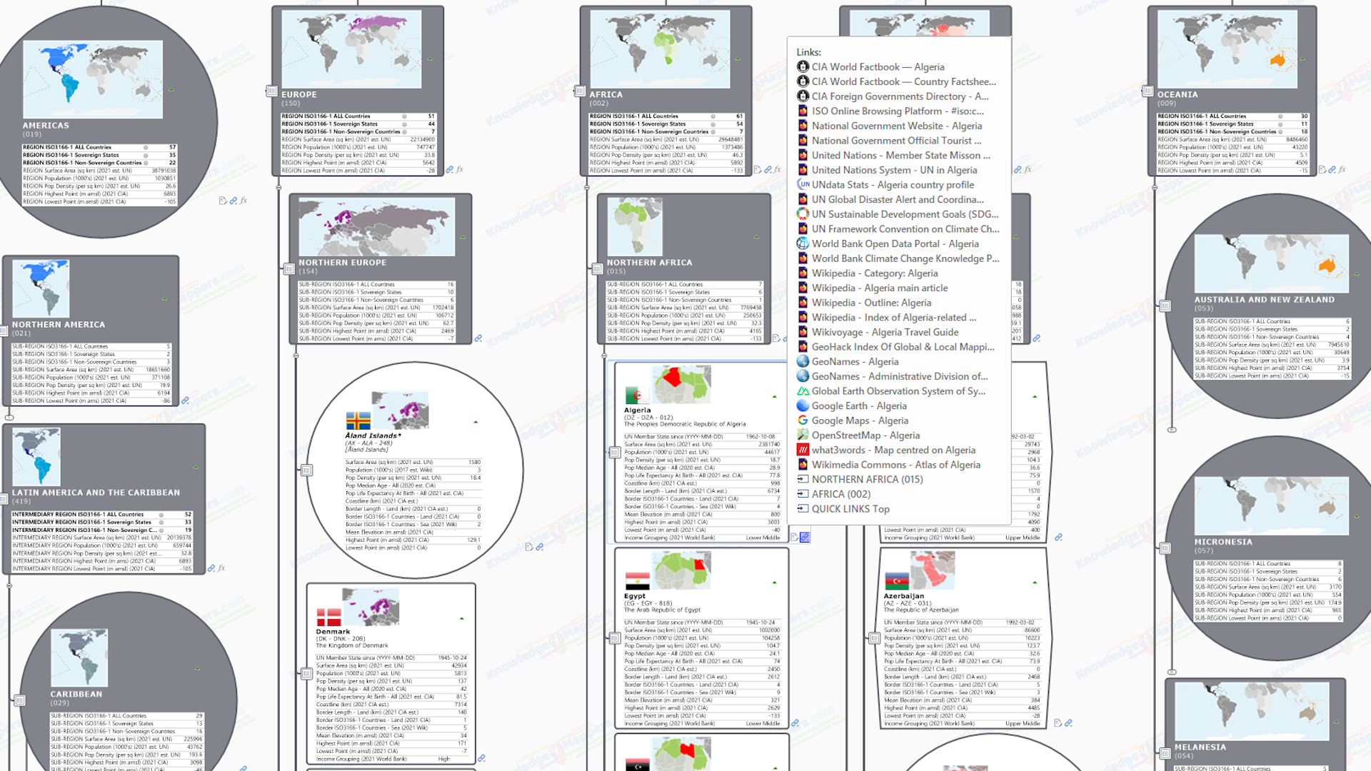
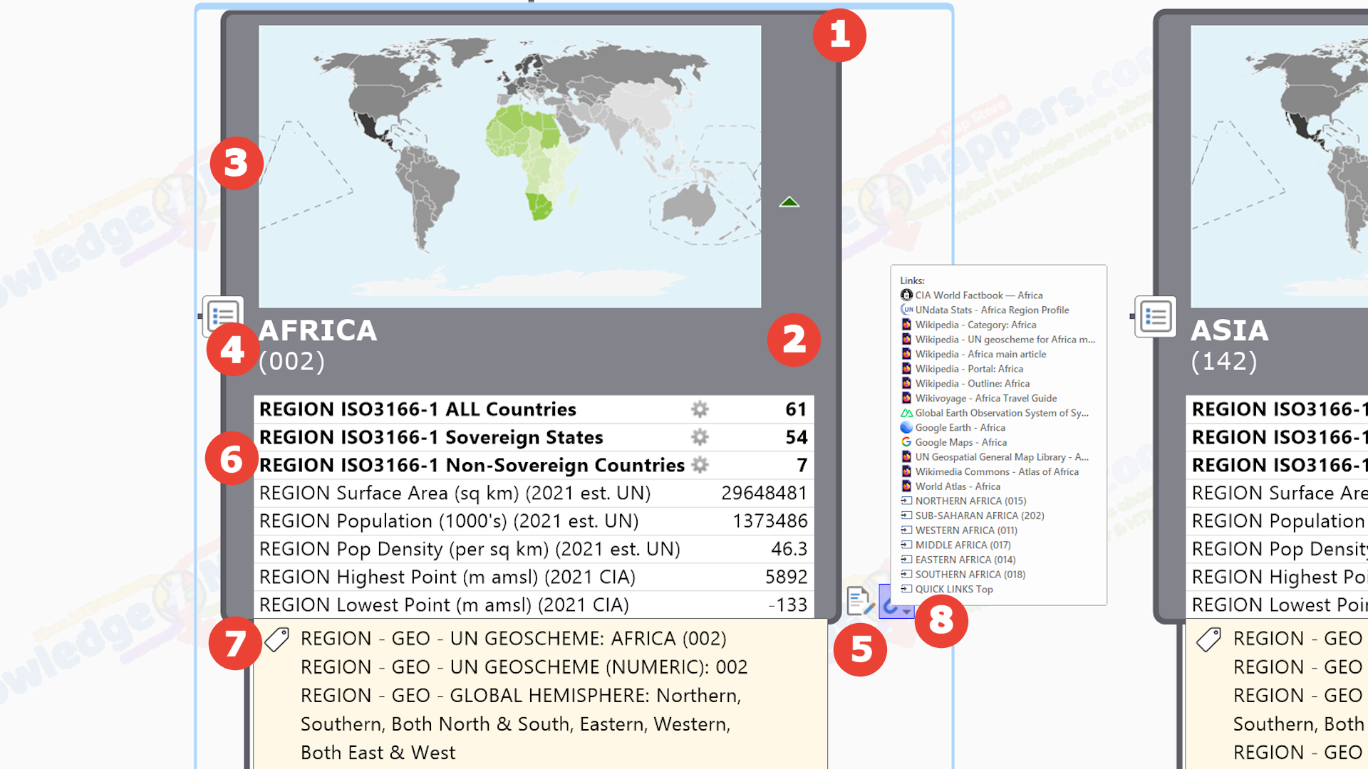
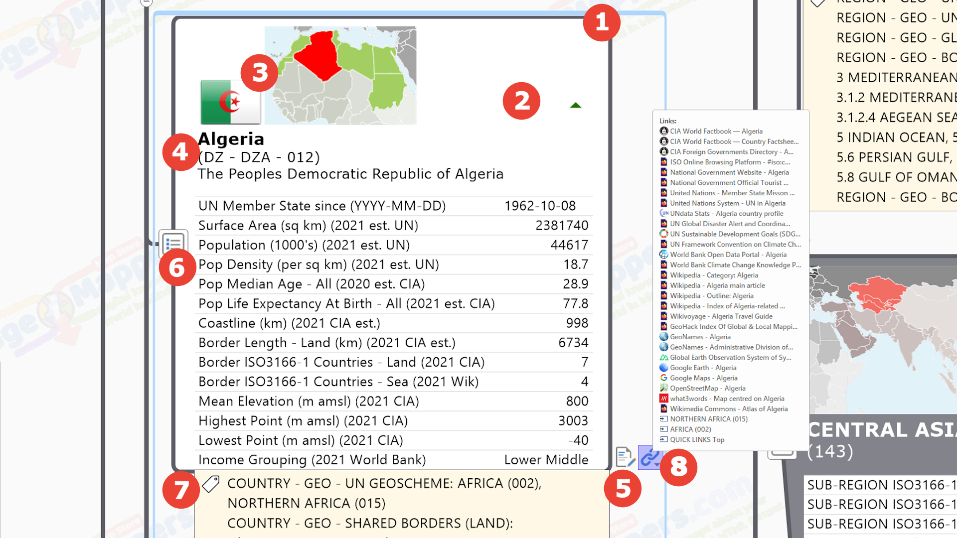
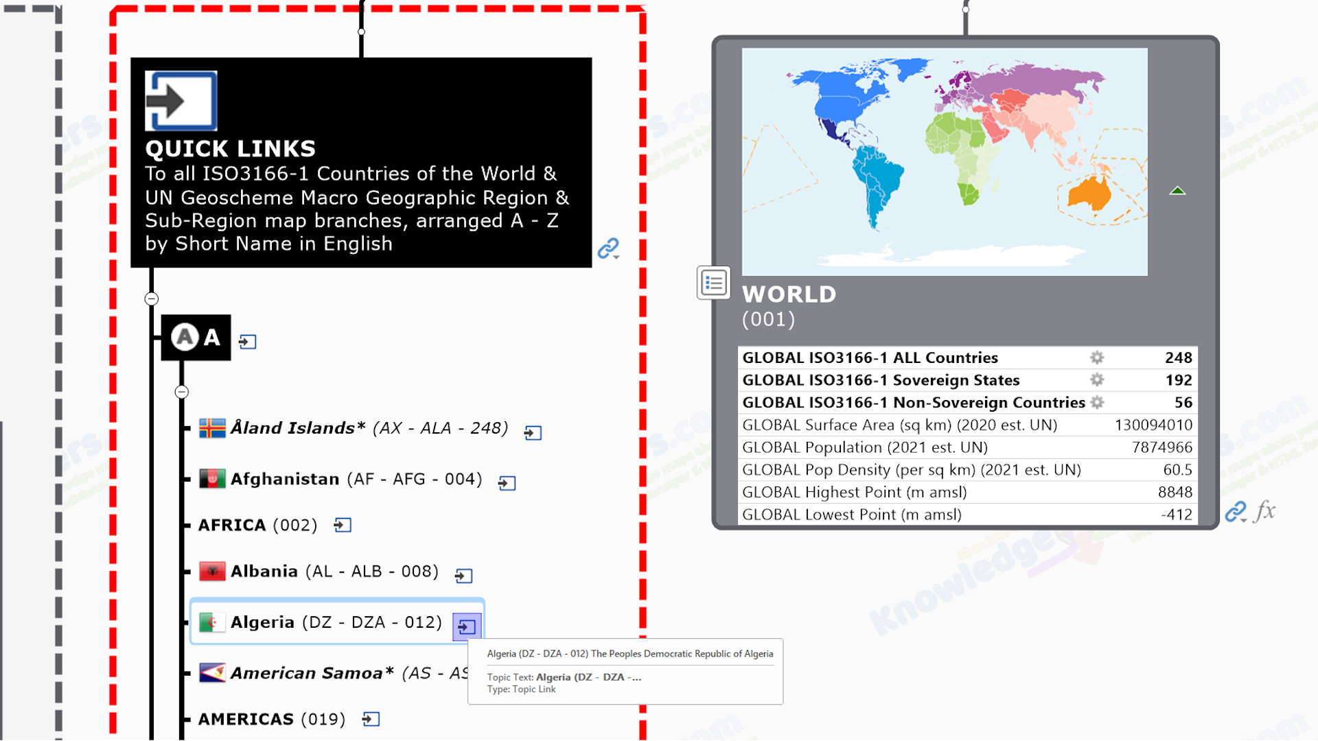
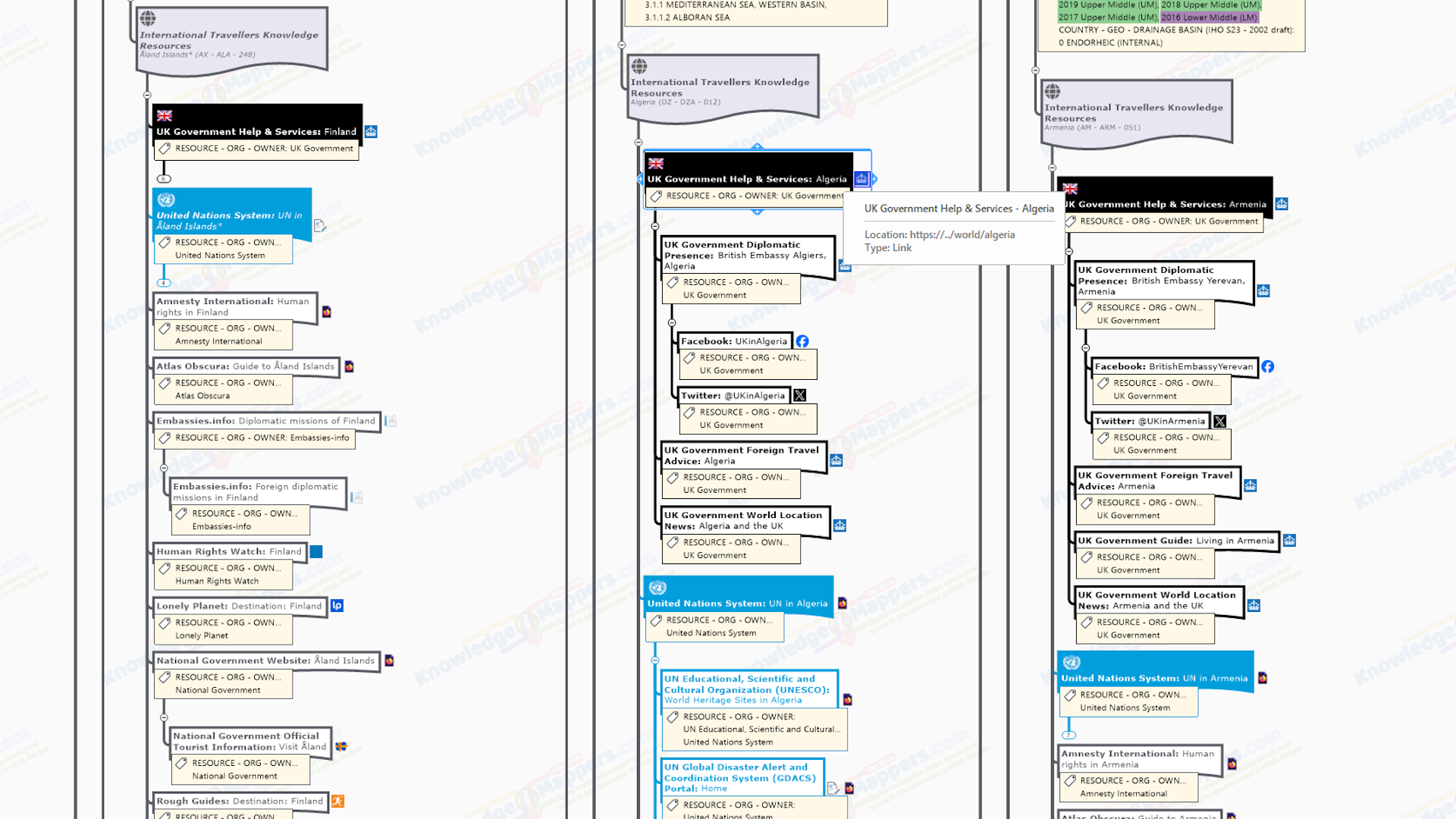
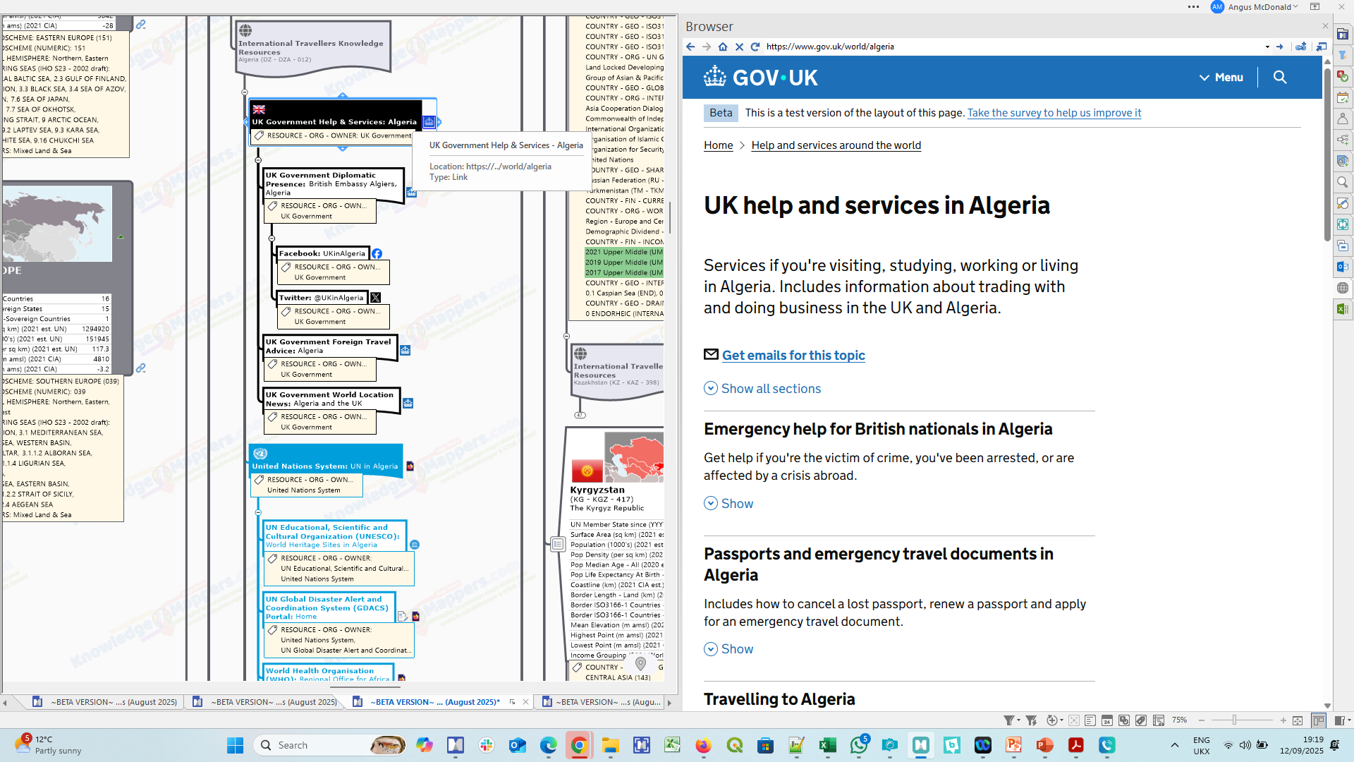
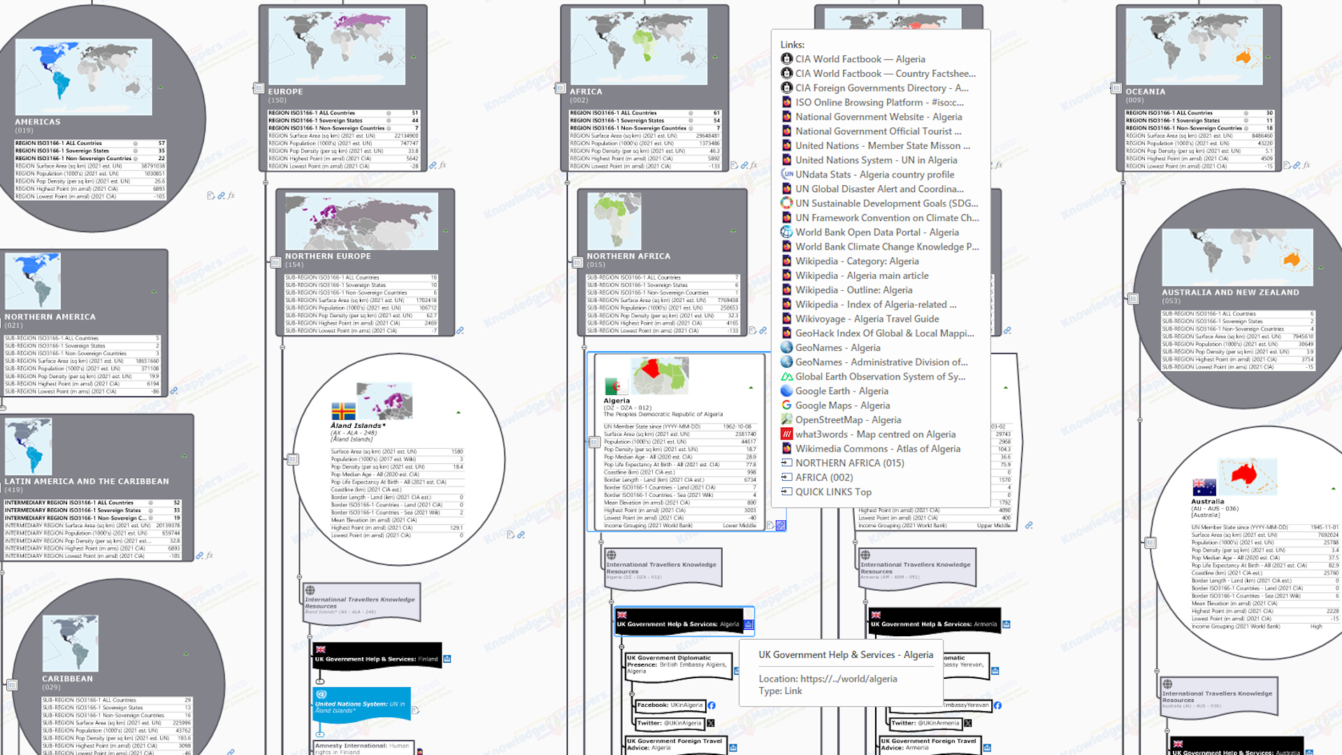
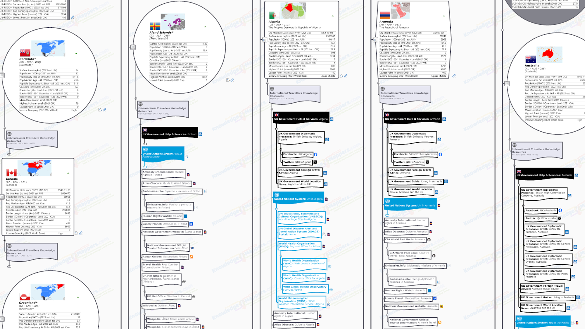
If there is only one link attached to a branch then the icon indicated above will be displayed at the end of it, and clicking on the icon will ‘activate’ the link. However if a branch has more than one hyperlink attached to it, the single link icon will be replaced by a chain link icon  . The process for activating any of the attached multiple links varies between the MindManager and HTML versions of the map….
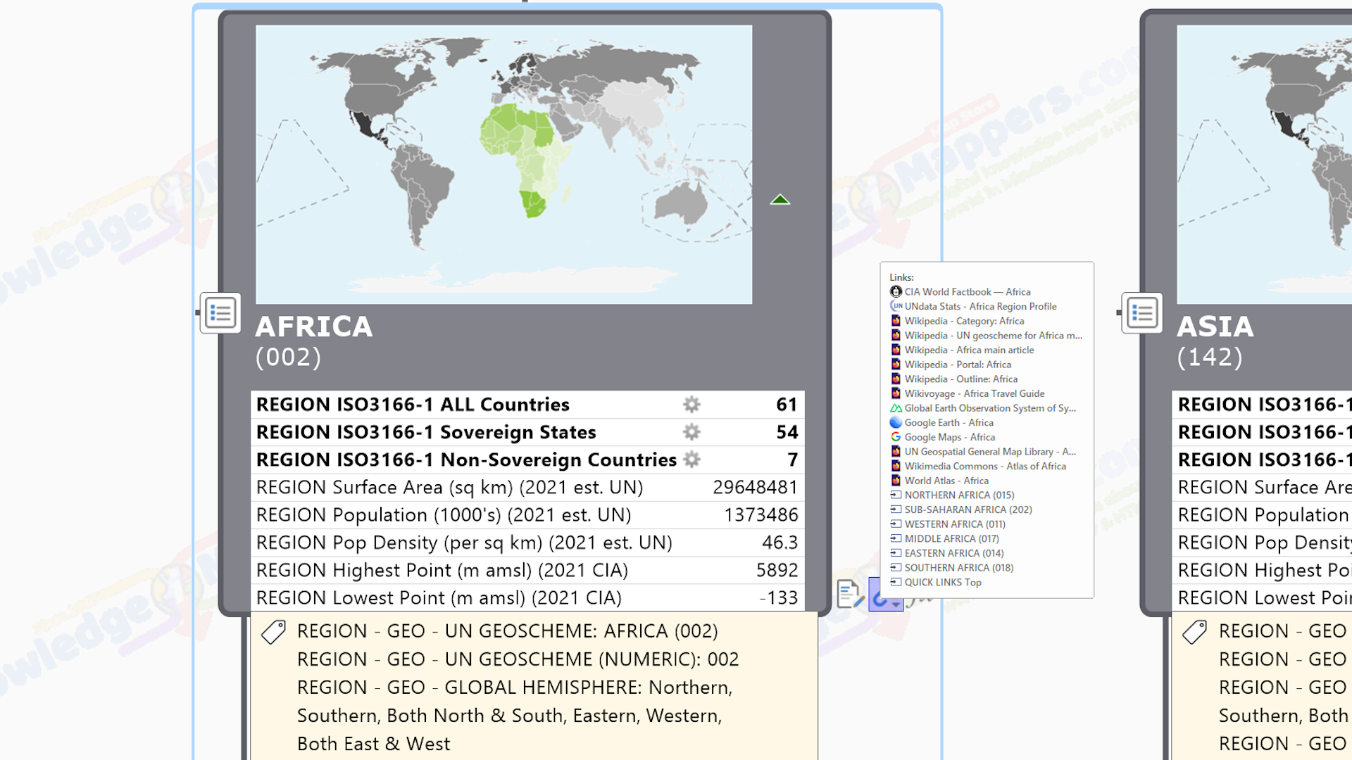
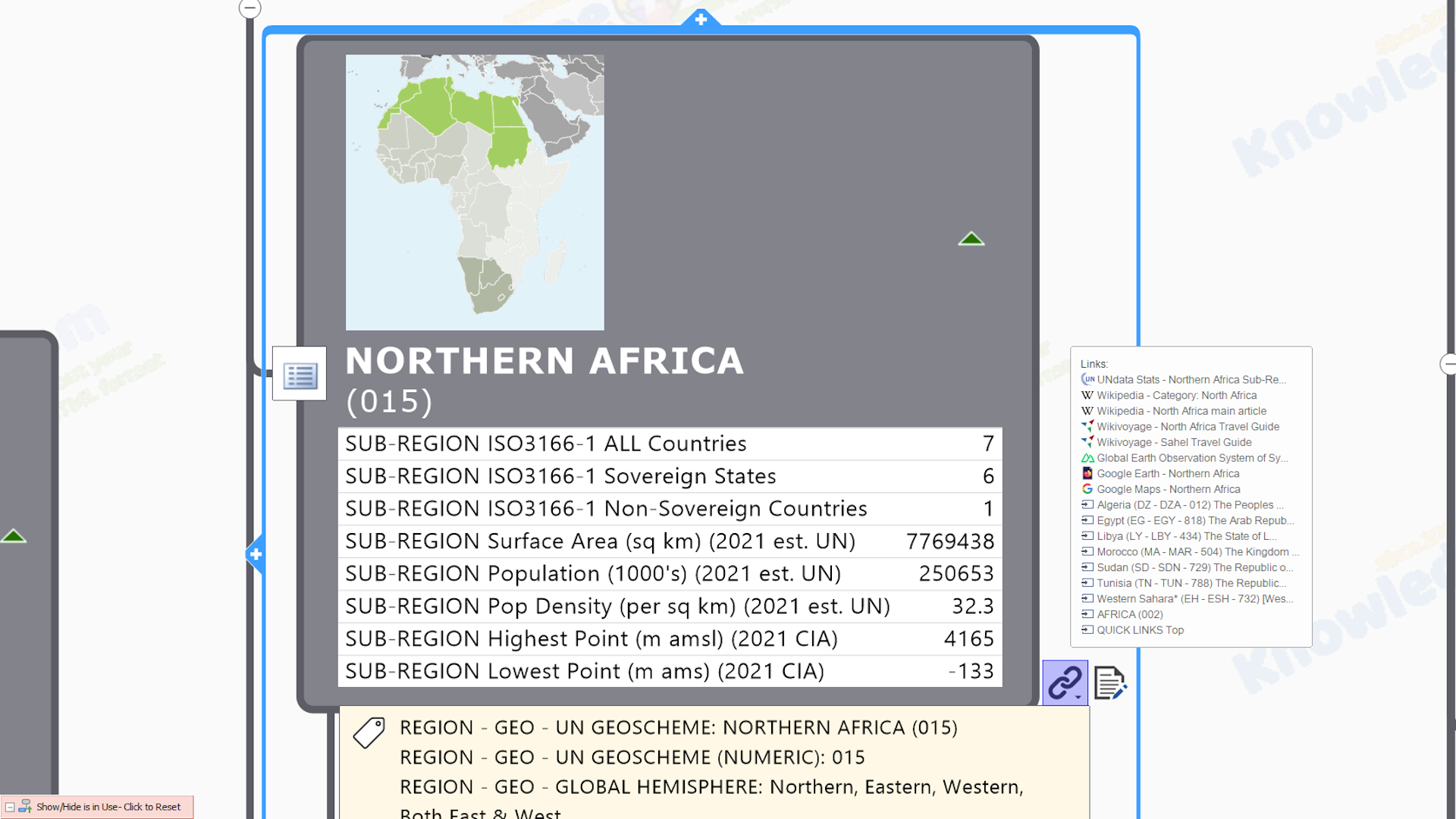
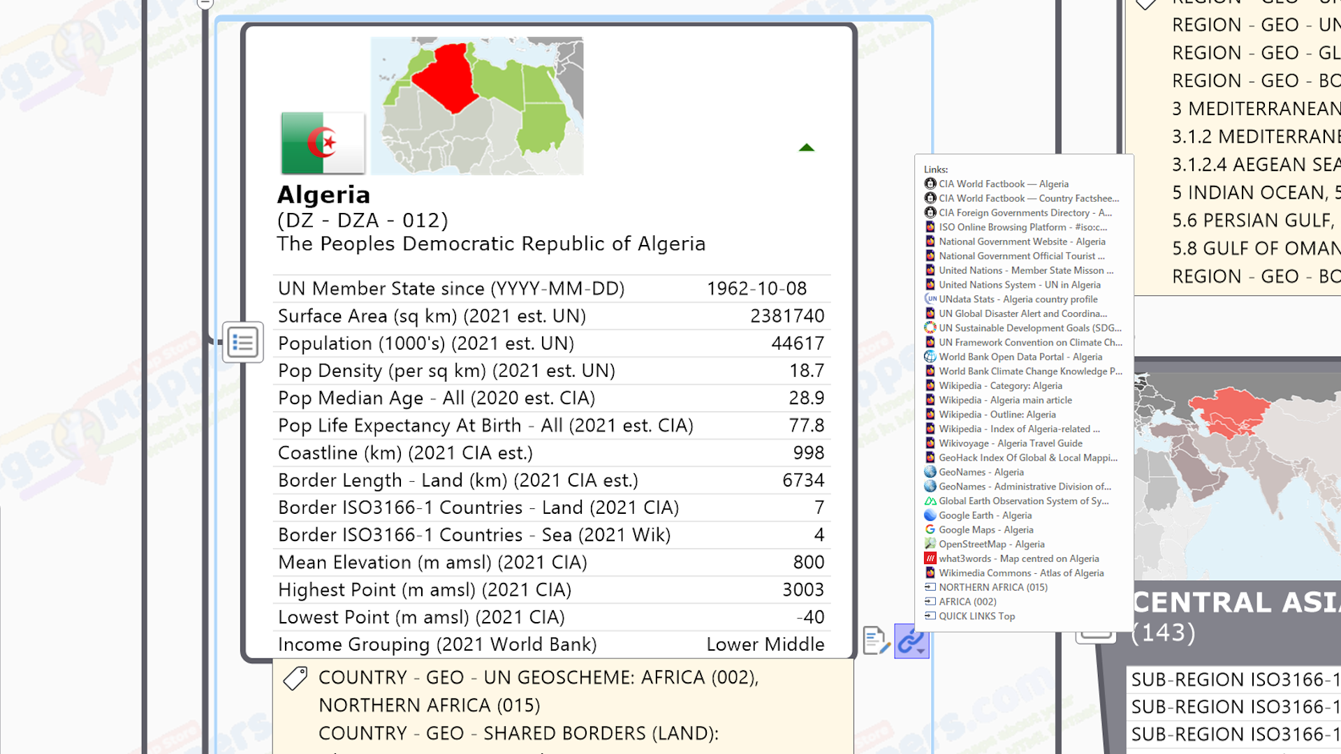
 MindManager Map – Clicking on the chain link icon will reveal a ‘dropdown panel’ listing all the links, each with their icon beside it, and clicking on any one will activate it.
 HTML Map – Clicking on the chain link icon will open the links tabs in the sidebar of the browser window, where all the links will be listed beside their icons. Click on one to activate and off you go. (Note prior to MindManager 2024 the HTML export map separated external and internal links into 2 separate tabs – external to Attachments & Links’ Tab indicated by the icon, and internal to the ‘Related Topics’ Tab indicated by the icon).
.
Most of the links in our knowledge maps will be to external URLs (with occasional e-mail links if the map includes people such as elected representatives), but there are usually also a few internal links to other map branches from the main framework and seed branches to improve internal navigation. Though it is possible to attach files to maps, it is not something that we do so that we can keep the file size to a minimum, however there may also be the occasional direct link to an online PDF file (i.e. clicking the link will immediately download the file to your device).
Finally it should be pointed out that, even though we have differentiated the links attached to this seed branch into different ‘types’, this is for descriptive convenience only as they are all displayed on a single list. However we usually add them such that they display in the following order….
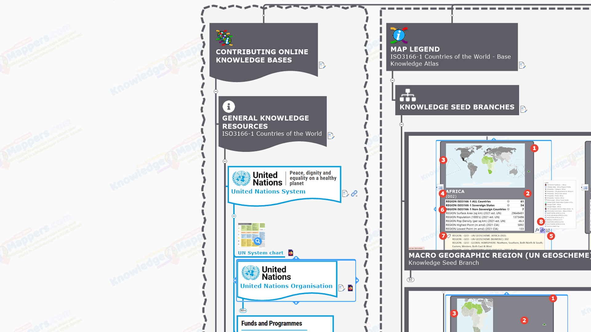
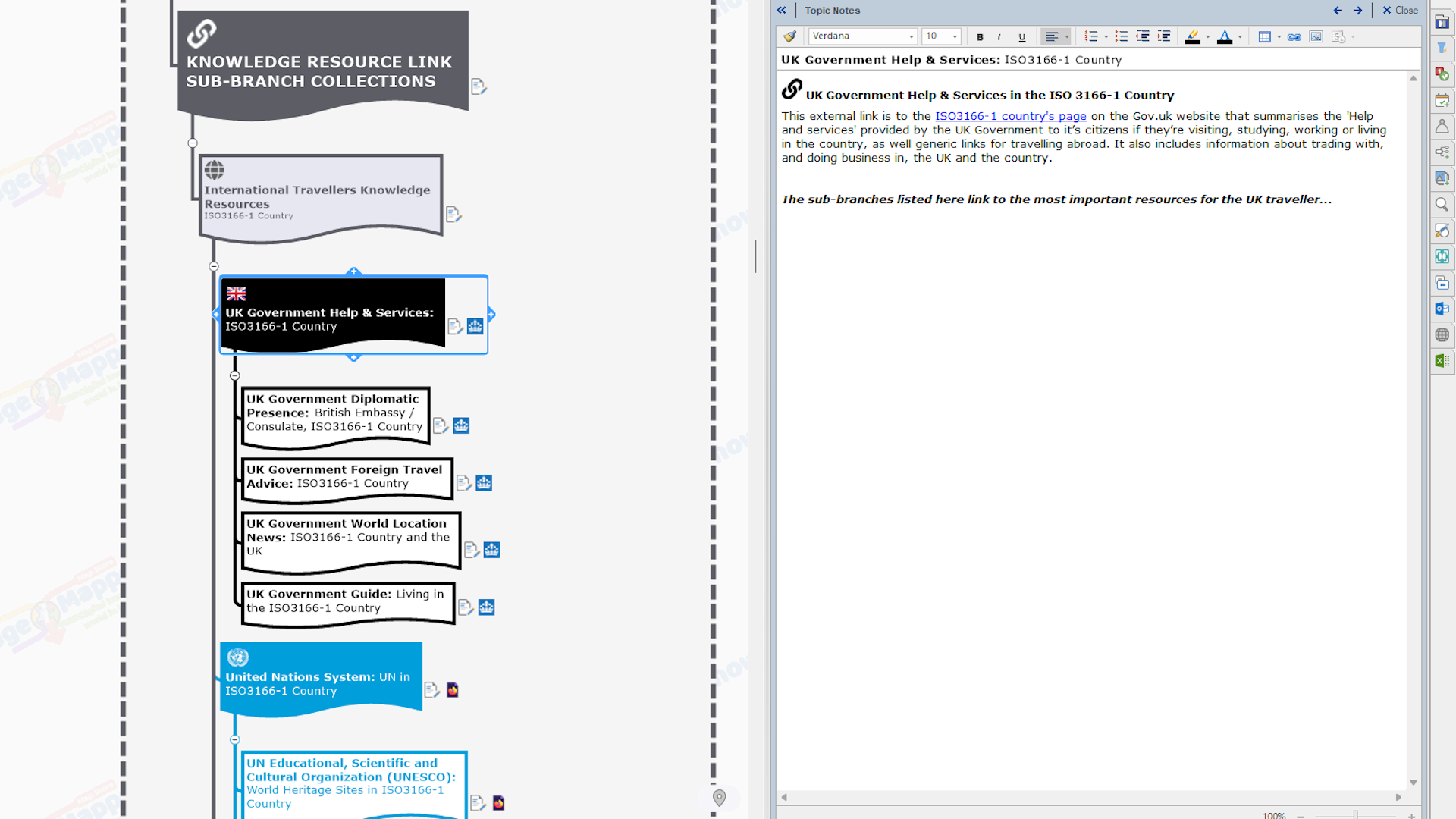
External Knowledge Resource Links

 External links to core General Knowledge Resources (arranged A-Z by site name i.e. links to Wikipedia are generally low down if not last).
 External links to core Geographic Knowledge Resources (arranged A-Z by site name i.e. links to Wikipedia are generally low down if not last).
Internal Navigation Links to other branches.
.
.
External Knowledge Resource Links
Mutiple hyperlinks to original official / definitive / plain old useful knowledge sources, freely available in the online public domain, is one of the main features of our knowledge maps. By doing this….
- original sources get used more often, by more people thereby improving user metrics (such resources are often created & maintained at public expense).
- resource wheels are not being re-invented because potential users don’t know it already exists.
- conversely in the circular knowledge economy way of crowd-sourced websites like Wikipedia, if there is knowledge that users could add to an existing page that is linked to, or even starting a new page that is missing from the knowledgebase, then everybody will benefit even more.
- errors get spotted quicker as ‘there are more eyes on’, thereby improving the quality for everybody.
- updates get promulgated sooner to end users.
- rather than us having to interpret original sources to create further information resources around “big picture” context for a subject we are not experts in, users of our map can “get it straight from the horses mouth” as it were, so everybody benefits.
.
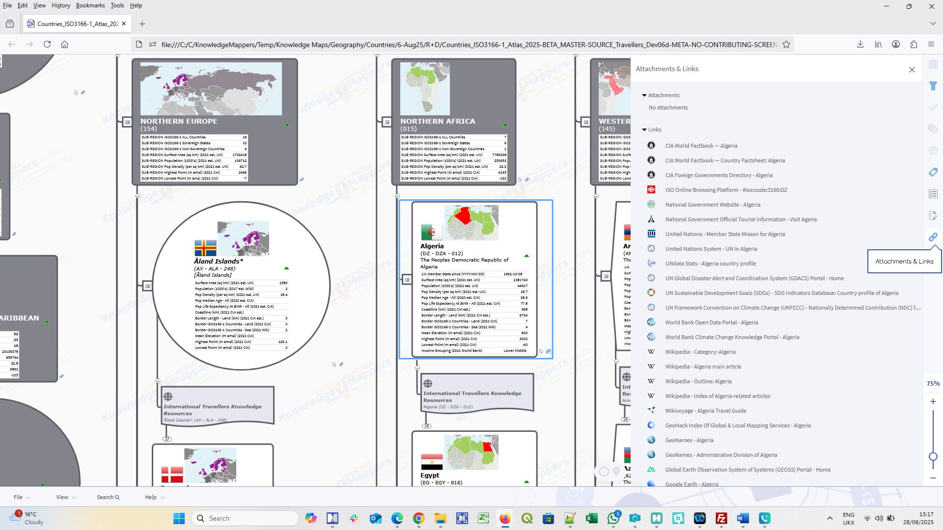
The following external knowledge resource links are attached to this seed branch (arranged in alphabetical order within the groupings)….
.
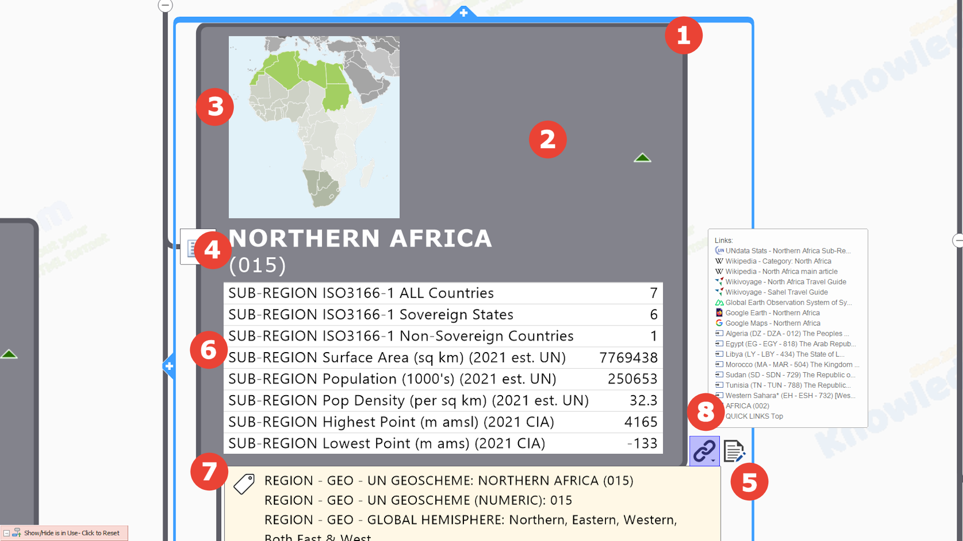
General Information Knowledge Resource Links
These are links to selected ‘core’ official / definitive / ‘plain old useful’ general knowledge resources about the macro geographic region / sub-region. They are an ideal starting point for those who want to find out more about about it, be it for casual interest or more focused desktop research for a specific purpose.…
 Other Resources
Resources that aren’t created by United Nations System organisations or Wikimedia projects….
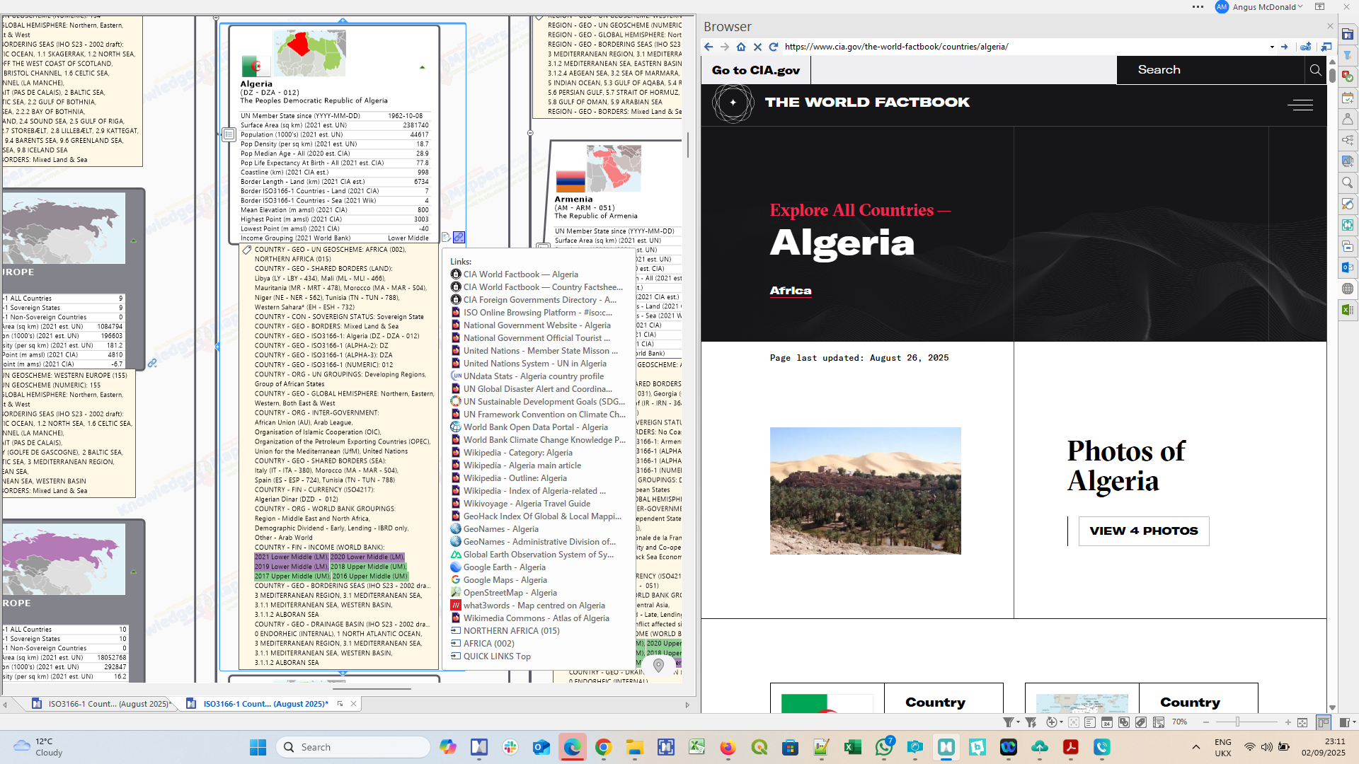
 CIA World Fact Book: ISO3166-1 Country Profiles – Maintained regularly by the US Central Intelligence Agency, the World Fact Book contains information on the history, people, government, economy, energy, geography, communications, transportation, military, and transnational issues for 267 world entities. The Reference tab includes: maps of the major world regions, as well as Flags of the World, a Physical Map of the World, a Political Map of the World, a World Oceans map, and a Standard Time Zones of the World map.
CIA World Fact Book: ISO3166-1 Country Factsheet – ‘One page’ summary of key geostatistical facts and graphics about the country distilled from it’s entry in the main CIA World Fact Book under the categories of Geography, People & Society, Government and Economy.
CIA Foreign Governments (‘World Leaders’) Directory: ISO3166-1 Country Pages – The US Central Intelligence Agency publishes and updates the online directory of Chiefs of State and Cabinet Members of Foreign Governments weekly. The directory is intended to be used primarily as a reference aid and includes as many governments of the world as is considered practical, some of them not officially recognized by the United States. Regimes with which the United States has no diplomatic exchanges are indicated by the initials NDE.
ISO3166-1 Online – The official entry for the country and it’s sub-division’s codes in the International Standards Organisation online standards portal.
National Government Website – Home page of the official website of the national government of the ISO3166-1 country so those not from the country to find a way in to the machinations of the government (for whatever reason). As ever though there is great variation in the type of site they are and what sort of information they offer the unfamiliar visitor :-(.
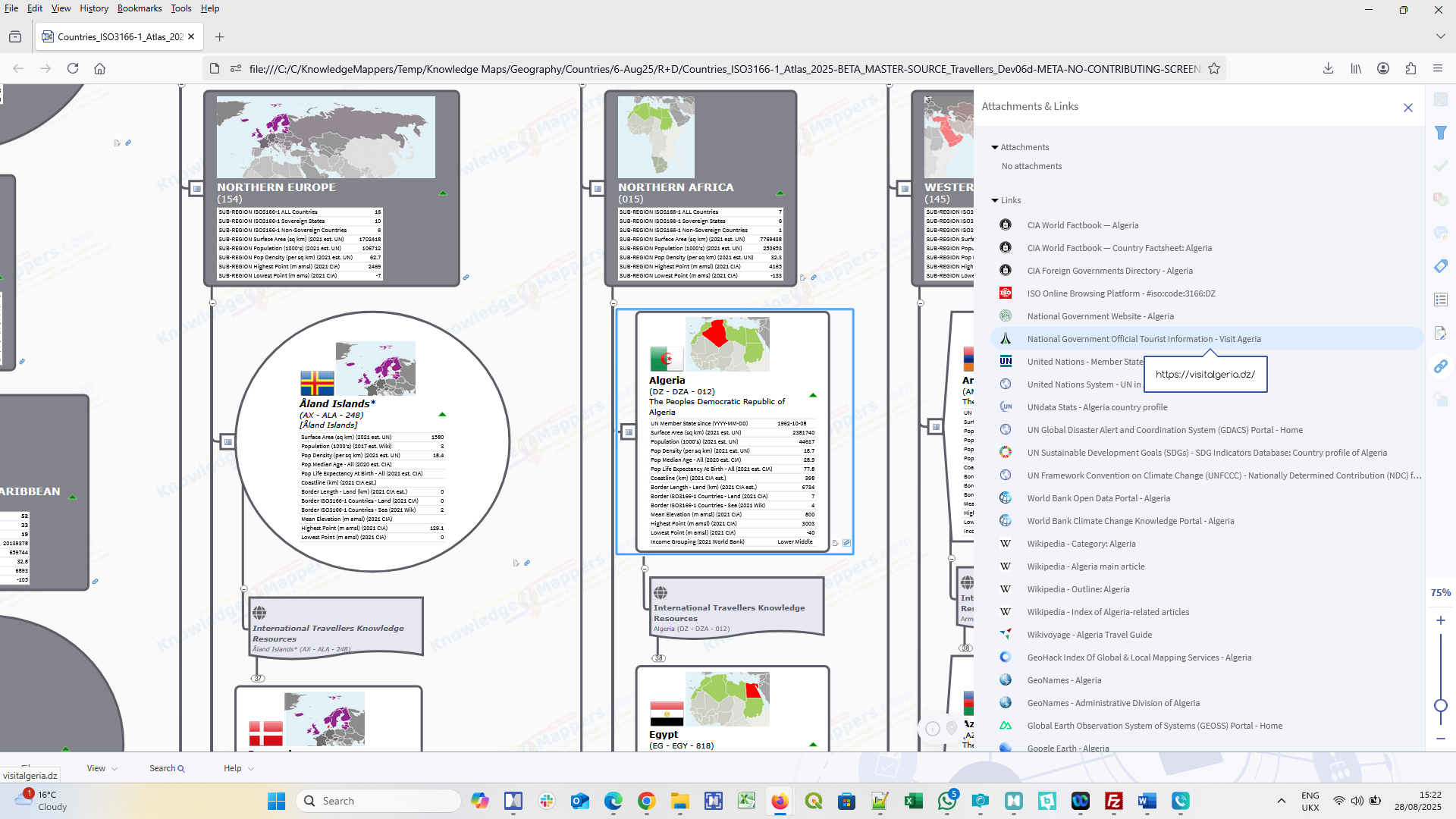
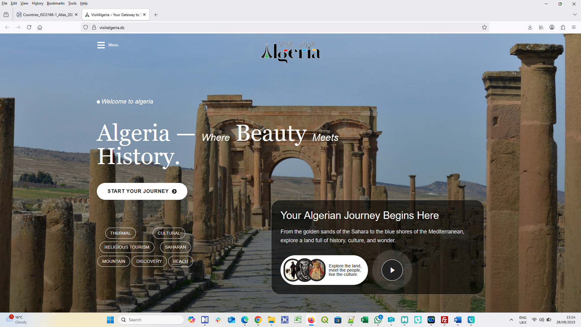
National Government Tourist Information Website – Home page of the official tourist information website for visitors to the ISO3166-1 country, usually created by the national tourism authority. They vary in breadth of content and functionality (e.g. some enble users to book accomodation and activities), but they all provide some pretty pictures of the country and local colour to whet the traveller’s appetite, and contact information to find out more. And Unlike commercial tourist information guide type resources, which tend to concentrate on the most popular destinations, there is a national tourist information website for every ISO3166-1 country, including all the non-sovereign territories.

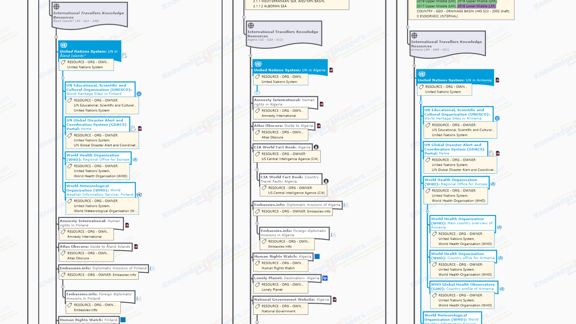
 United Nations System Resources
Unsurprisingly the many bodies that make up the United Nations System produce many general knowledge resources about the countries of the world….
United Nation Member State Mission – Website of the Member State Misson. Some are hosted by the UN, some by the country itself so they vary in style.
UNdata Stats – Official statistics about the country compiled, published & maintained by the United Nations Statistics Division (UNdata).
UN Global Disaster Alert and Coordination System (GDACS) Portal – Real-time access to official web-based disaster information systems and related coordination tools for recent (last 5 days) earthquakes, tropical cyclones, floods, volcanic eruptions, droughts and forest fires.
UN Sustainable Development Goal (SDG) Indicators Database Country Profile – The SDG Global Database provides access to data on more than 210 SDG indicators for countries (Member States), areas or regions across the globe.
United Nations Framework Convention on Climate Change (UNFCCC): Nationally Determined Contributions (NDC) Registry – The country’s total carbon contributions as agreed under the United Nations Framework Convention on Climate Change (UNFCCC) (‘Paris Agreement’).
World Bank Open Data Portal – Free and open access to the global development data about countries or development indicators held by the World Bank. Graph, map and compare more than 1,000 time series indicators from the World Development Indicators by Topic, Theme and SDG Goal.
World Bank Climate Change Knowledge Portal – Global data on historical and future climate, vulnerabilities, and impacts. Explore them via Country and Watershed views. Access synthesized Country Profiles to gain deeper insights into climate risks and adaptation actions.
 Wikimedia Project Resources
Wikipedia has many portals, outlines, categories, main articles & lists that are geographic knowledge resources about the countries of the world, however there are also other Wikimedia Projects of interest….
Wikipedia Category: ISO3166-1 Country – List page of all country related categories.
Wikipedia: ISO3166-1 Country Main Article – This is the main Wikipedia article summarising the etymology, history, geography, administrative divisions, politics, economy, demographics & culture of the country. It also serves as a jumping off point to the many, more detailed Wikipedia articles on the country, as well as external sources on the web.
Wikipedia: ISO3166-1 Country Portal – Wikipedia Portals are another useful entry-point that help readers and/or editors navigate their way through Wikipedia topic areas, promote content and encourage contribution. They may be associated with one or more WikiProjects, such as those concerned with gathering & publishing the information related to each country on Wikipedia.
Wikipedia: ISO3166-1 Country Outline Page – Outlines are an introduction to the ISO3166-1 country structured as a series of hierarchical lists of links to essential Wikipedia resources about it.
Wikivoyage: ISO3166-1 Travel Guide – Another Wikimedia project, Wikivoyage is built in collaboration by volunteer authors from around the globe who write without pay, with the spirit of sharing knowledge that makes travel so enjoyable. Whenever travellers meet each other on the road, they swap info about the places they came from and ask questions about places they’re going. We want to make it easy to share that knowledge and let others share it.
.
Geographic Information Knowledge Resource Links
These are links to selected ‘core’ official / definitive / ‘plain old useful’ geographic knolwedge res.ources about the about the macro geographic region / sub-region. It is a mixture of….
- Static Map Libraries – Collections of human created cartographic image files that can be downloaded and viewed offline.
- Online Mapping Services – Automatically generate maps, often with different ‘layers’ of related geographic features that can be turned on or off and additional useful geographic tools (eg. route finder). These can usually only be accessed via a live internet connection.
- Spatial Data Repositiories – Containing data files of computer-readable geographic information for use by anybody with the right specialised (‘GIS’) software. As well as being downloadable files, they may also be available as a feature service that is streamed directly to your application using an API.
.
Other Resources
Resources that aren’t created by United Nations System organisations or Wikimedia projects….
GeoHack Index Of Global & Local Mapping Services: ISO3166-1 Country – Tool used by Wikipedia & other projects to access web mapping services centred on geographically referenced entities (such as countries of the world). As well as global services like Google Maps and Open Street Map, local services, such as those provided by national mapping agencies, are also listed.
GeoNames: ISO3166-1 Country Page – Country main page on the GeoNames website, which lists various codes and statistics related to it along with a simple line map showing the sub-divisions. There are links to sub-pages for Administrative Divisions, Feature Statistics, Largest Cities, Highest Mountains, Other Country Names and Postal codes. The website is populated from the GeoNames database – which contains over 25 million geographical names, over 11 million unique features of 4.8 million populated places and 13 million alternate names.
GeoNames Administrative Divisions of ISO3166-1 Country – The ISO3166-1 country’s Administrative Divisions page, which is a sub-page of the main country page, lists all the ISO3166-2 sub-divisions of the ISO3166-1 country (along with a link to the Wikipedia main article about it), along with it’s codes, capital and population, with links to a further summary page for each containing data from the Geonames database.
Global Earth Observation System of Systems (GEOSS) Portal – Link to the home page of the Global Earth Observation System of Systems (GEOSS) Portal, on which over 400 million data and information earth observation resources are accessible (use the ‘Advance Search’ feature to select a continent or country from the drop down menu, and then datasets, themes and time windows).
Google Earth: ISO3166-1 Country – View centred on the ISO3166-1 country page on the web version of Google Earth, showing it’s international boundaries highlighted in the map, along with information and pictures about it in the sidebar.
Google Maps: ISO3166-1 Country – Link to Google Map map centred on the country.
Open Street Map: ISO3166-1 Country – Link to Open Street Map map centred on the country.
What 3 Words – View centred on the ISO3166-1 country on the map interface of the what3words geo-location service (or more precisiely it is to the named what3words ‘grid square’ that is at ‘the centre’ of it, as given when the country name is typed into the search box).
United Nations System Resources
Unsurprisingly the many bodies that make up the United Nations System produce many general knowledge resources about the countries of the world….
UN Geospatial General Map Library: ISO3166-1 Country – The country’s ‘profile map’ in the United Nations Geospatial Division’s General Map Library, which provides an overview of Member States and territories worldwide including their overall international context, main populated places, administrative units, general infrastructure, and hydrology.
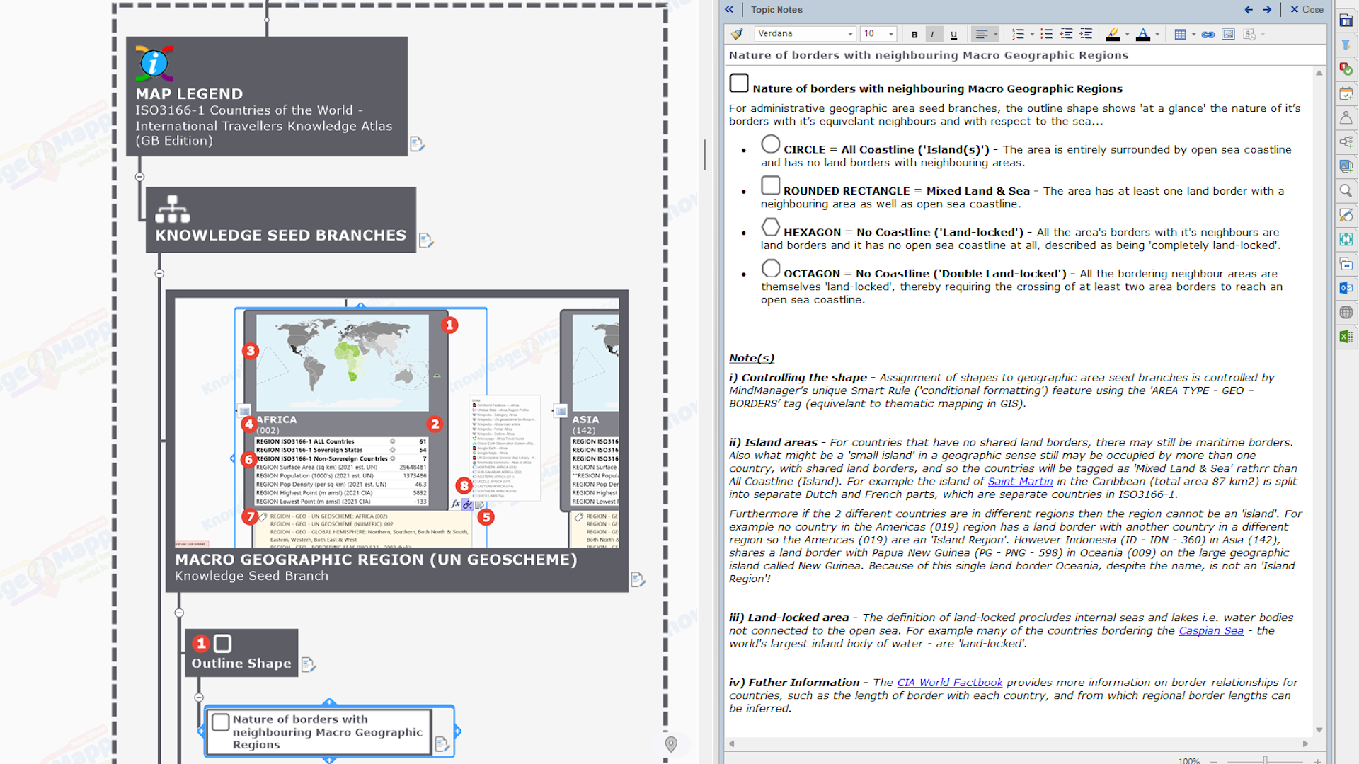
Note(s)
i) Incomplete coverage – Perhaps surprisingly, maps of many of the UN-defined Macro Geographic Regions and Member States (ie. ISO3166-1 Countries) are not included in the map library.
Wikimedia Project Resources
Wikipedia has many portals, outlines, categories, main articles & lists that are geographic knowledge resources about the countries of the world, however there are also other Wikimedia Projects of interest….
Wikimedia Commons Atlas Of The World: ISO3166-1 Country – The Wikimedia Atlas of the World is an organized and commented collection of geographical, political and historical maps available at Wikimedia Commons.
.
General Note(s)
i) Multiple hyperlinks on a branch – MindManager has the unique ability to have multiple hyperlinks attached to a single map branch, and to edit the default title text of the link to make it more meaningful to the user. This….
- greatly reduces the visual clutter of the map.
- means a full basket of links to official / definitive / useful knowledge resources about the subject can stay with the seed branch if it is re-used in other maps.
The chain icon at the end of a branch (rather than the favicon (icon) served by the linked-to website) indicates where a branch has more than one hyperlink.
ii) Give back if you can – In the circular knowledge economy way of Wikipedia if there is knowledge that you could add to an existing page that is linked to, or even starting a page that doesn’t yet exist, then go for it! That’s what it’s all about!
iii) Not all resources exist – Not all of the above resources will exist for all ISO3166-1 Countries.
.
.
Internal Navigation Links
Internal hyperlinks enable users to quickly jump from one branch to another without any of that tiresome scrolling & expanding, or searching i.e. internal navigation.
.
The following internal links are attached to this seed branch….
.
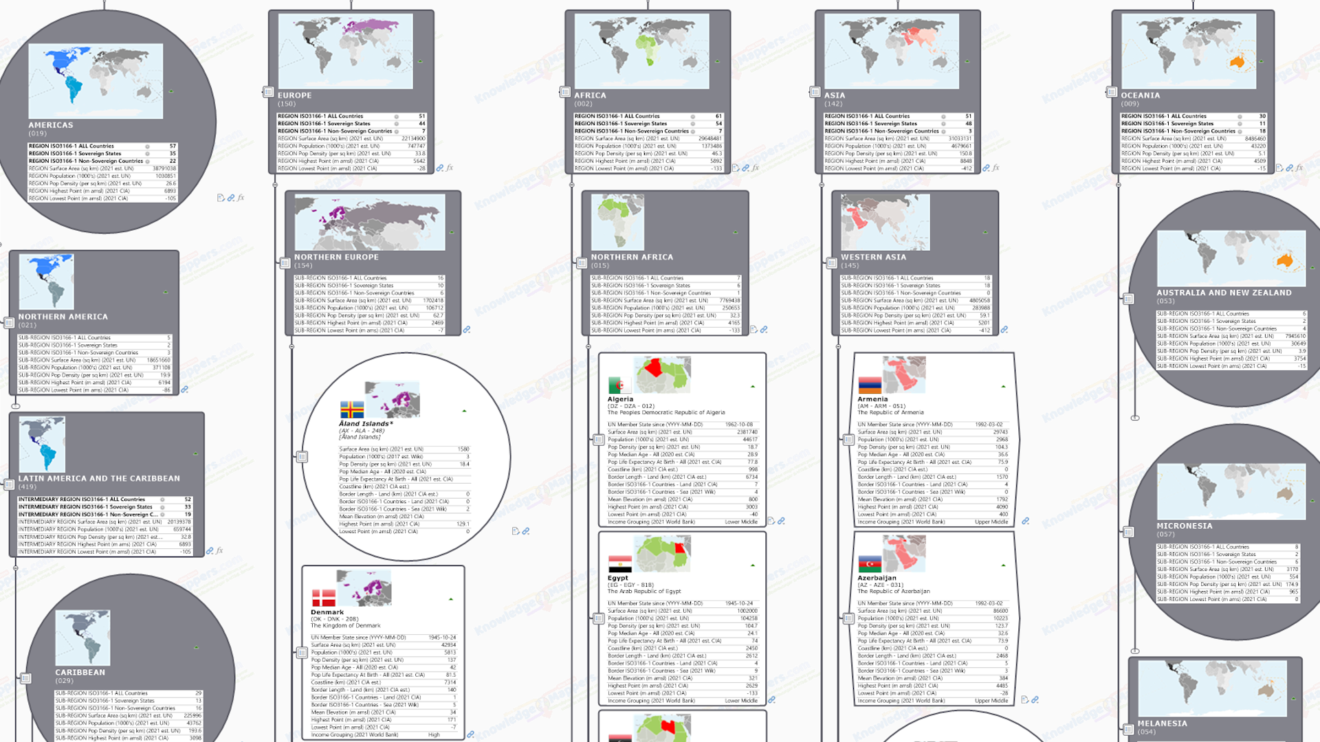
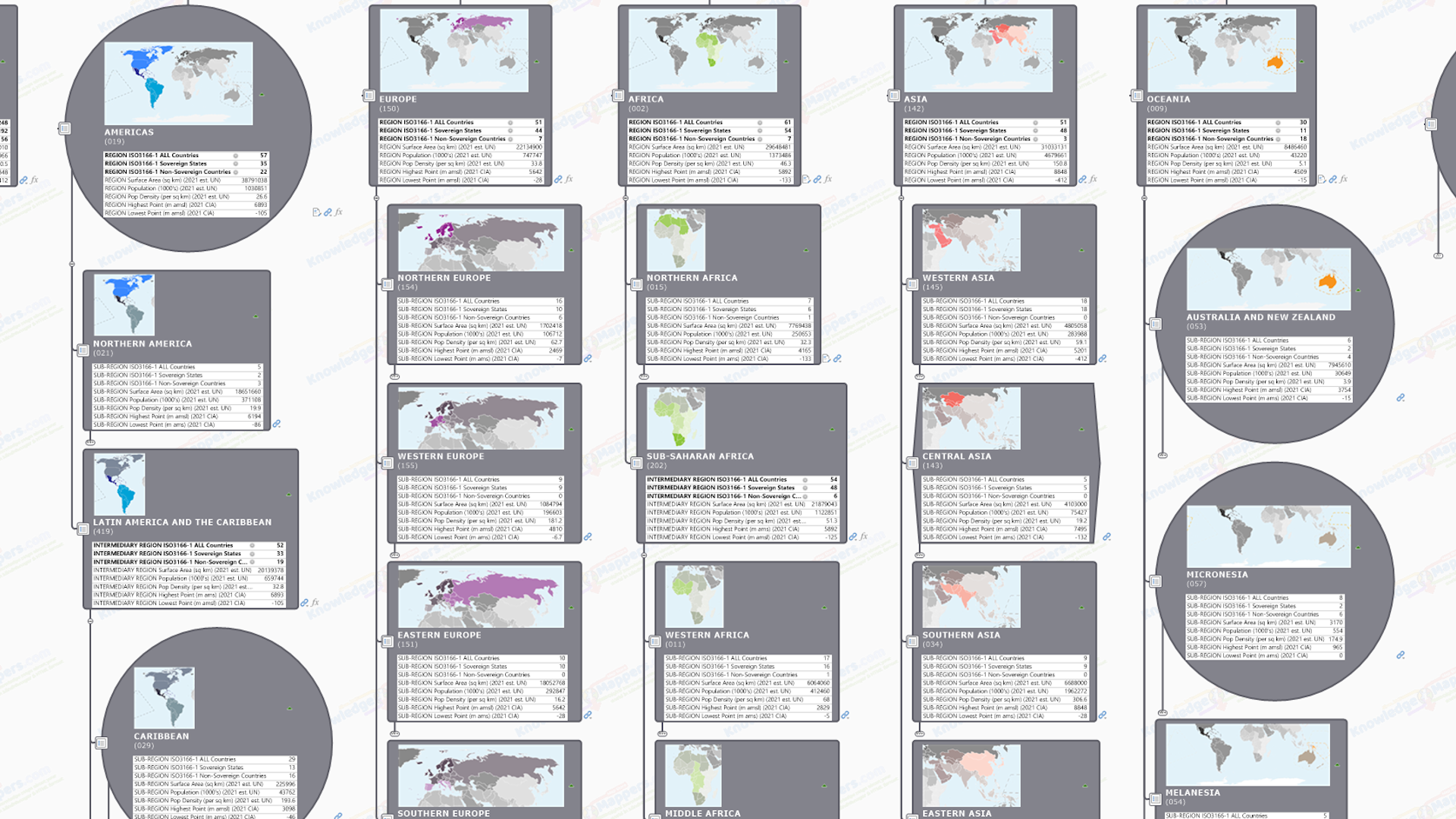
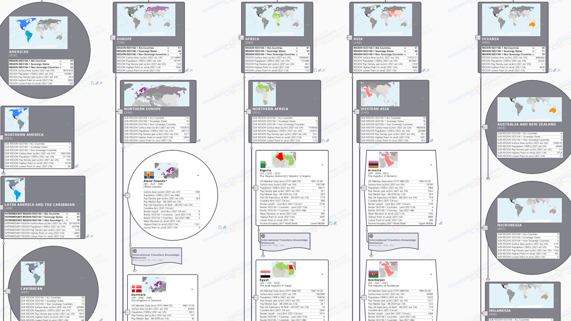
Between Countries and their ‘parent’ Regions and Intermediary / Sub-Regions – Attached to Country seed branches there are internal links to bothe their Macro-Geographic Region and Sub-Region ‘parent’ seed branches i.e. ‘up the tree hierarchy’ only. On intermediary region / sub-region seed branches there are internal links ‘up the tree hierarchy’ to the ‘parent’ region seed branch, and down to all it’s country sub-branch seed branches.
Quick Links Branch – All the region, sub-region and country seed branches have an internal link back to the ‘parent’ Quick Links branch. From there users can get to any other area seed branch by internally navigating to it’s linking branch within the Quick Links alphabetic structure, including back to the branch they ‘jumped’ from.
Note(s)
i) Internal links may not be reciprocal – though a link may take users to another branch in the map, there may not be a reciprocal internal link attached to it that takes you back to the branch you ‘jumped’ from. It all depends on the nature of the relationship and why the link was added in the first place – some may just be to get you to related content rather than internal navigation.
.
General Note(s)
i) Freely available – All knowledge resources linked to in our collections are freely available in the public domain.
ii) Not all resources – Not all of the knowledge resources listed above exist for all ISO3166-1 countries. This is especially true for non-sovereign states, which may be fully autonomous or semi autonomous from the home state, or may be a fully integrated part of it.
iii) Sub-branch Link Collections vs Multiple Hyperlinks – The (currently ~30) Multiple Hyperlinks attached to this ISO3166-1 Country seed branch are to ‘core resources’ selected from the General and Geographic Knowledge Resource Sub-branch Link Collections that are the main focus of our Countries of the World – General & Geographic Knowledge Atlas (which in turn is built on the Countries of the World – Base Knowledge Atlas that has these seed branches as part of it’s core framework and upon which all our Countries of the World knowledge atlas maps are built – so it’s all very meta ;-).


